Mars in the Space Age
 Mars was a natural target for exploration once we could send
probes through interplanetary space.
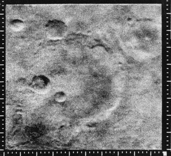
Mariner 4 delivered the first
close-up pictures of another planet on 15 July 1965 (July has been a big
month for Mars spacecraft). The
11th of its 21 TV images (right) was
especially noteworthy for showing many moonlike craters, which deflated
expectations that still hadn't quite faded from the age of canals
("Craters? Yuck. We've seen craters. It must be just like the moon!").
This was followed by the twin flyby missions of
Mariners 6 and 7,
arriving in July and August 1969. By now NASA could add a "far-encounter"
phases, bridging the gap between Earth-based views and close-up
detail. Mariner 7 paid special attention to the south polar cap.
Still, as luck would have it, these three missions managed to examine the
most boring possible slices of Mars.
Mars was a natural target for exploration once we could send
probes through interplanetary space.
Mariner 4 delivered the first
close-up pictures of another planet on 15 July 1965 (July has been a big
month for Mars spacecraft). The
11th of its 21 TV images (right) was
especially noteworthy for showing many moonlike craters, which deflated
expectations that still hadn't quite faded from the age of canals
("Craters? Yuck. We've seen craters. It must be just like the moon!").
This was followed by the twin flyby missions of
Mariners 6 and 7,
arriving in July and August 1969. By now NASA could add a "far-encounter"
phases, bridging the gap between Earth-based views and close-up
detail. Mariner 7 paid special attention to the south polar cap.
Still, as luck would have it, these three missions managed to examine the
most boring possible slices of Mars.
Our modern view of Mars started to emerge only with the global mapping
made possible when
Mariner 9 became the first artificial satellite
of another planet in 1971 (well, the first one we had anything to do with...).
After waiting out a planet-wide dust storm, it delivered images of
practically the whole Martian surface. As the dust settled, Mariner
9 revealed a whole new world. Enormous volcanoes, the vast canyons
(ever wonder why it's called
Vallis Marineris?), and,
most interesting, evidence that water once flowed in sufficient
quantity to leave not just channels, but flood deposits.
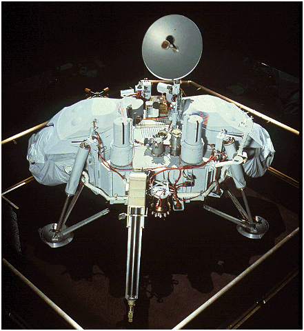
 The enormous interest in extraterrestrial life, and the long-standing
notion that Mars was the best place to look, led to the
Viking program - a
pair of orbiters and landers whose purpose was to analyze the Martian
soil. Viking 1 was originally scheduled to touch down on 4 July 1976
(the 200th anniversary of the Declaration of Independence), but
was delayed until 20 July by another dust storm (but that's an OK
anniversary date too). Lander 1 has the distinction of being the first
successful soft landing on Mars (the Soviet probe Mars 3 having
made it to the surface in 1971 but failed before returning any data beyond
that fact). Each lander carried stereo cameras, meteorological instruments,
and an extendible scoop to feed soil into three chemical experiments
which had been designed to detect Earthlike organisms through
searching for organic compounds, generating growth through
nutrient solutions, and measuring repiration with tagged
substances. One said yes, one said no, one was equivocal, so
most scientists (
though not all)
have regarded the evidence as easier explained by
the peculiar Martian surface chemistry. The landers operated through
an entire Martian year, and the Viking 2 orbiter continued
in operation for a decade. Together the mission pieces yielded
more than 50,000 images.
The enormous interest in extraterrestrial life, and the long-standing
notion that Mars was the best place to look, led to the
Viking program - a
pair of orbiters and landers whose purpose was to analyze the Martian
soil. Viking 1 was originally scheduled to touch down on 4 July 1976
(the 200th anniversary of the Declaration of Independence), but
was delayed until 20 July by another dust storm (but that's an OK
anniversary date too). Lander 1 has the distinction of being the first
successful soft landing on Mars (the Soviet probe Mars 3 having
made it to the surface in 1971 but failed before returning any data beyond
that fact). Each lander carried stereo cameras, meteorological instruments,
and an extendible scoop to feed soil into three chemical experiments
which had been designed to detect Earthlike organisms through
searching for organic compounds, generating growth through
nutrient solutions, and measuring repiration with tagged
substances. One said yes, one said no, one was equivocal, so
most scientists (
though not all)
have regarded the evidence as easier explained by
the peculiar Martian surface chemistry. The landers operated through
an entire Martian year, and the Viking 2 orbiter continued
in operation for a decade. Together the mission pieces yielded
more than 50,000 images.
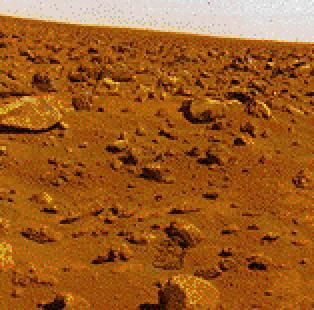
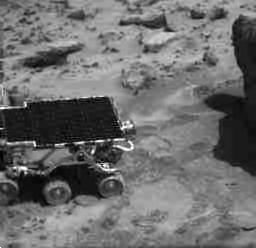
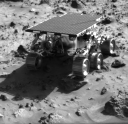
 The 1997 landing (July 4, in fact) of the
Mars Pathfinder spacecraft
and its Sojourner rover captured wise public attention. This was one of the
first news events in the Web, generating then-unprecedented millions of hits
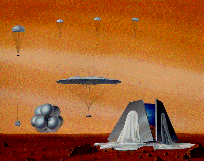
per day. The landing would have been something to watch, as the probe cut away
its parachute, inflated air bags, and bounced and rolled to a stop.
Mostly a technology demonstrator, the Pathfinder probe (now the Carl
Sagan Memorial Station) also carried a set of filters to allow
discriminating various kinds of rock and soil, while Sojourner
was equipped with an X-ray experiment that enabled it to derive the
chemical (though not minerological) makeup of individual Martian
rocks. This demonstrated, for example, that the Martian meteorites found
on Earth really did belong to Mars. The
landing site was chosen with
an old geologists' trick, picking an area which showed evidence of
having once been at the outlet of a flood where rocks from many
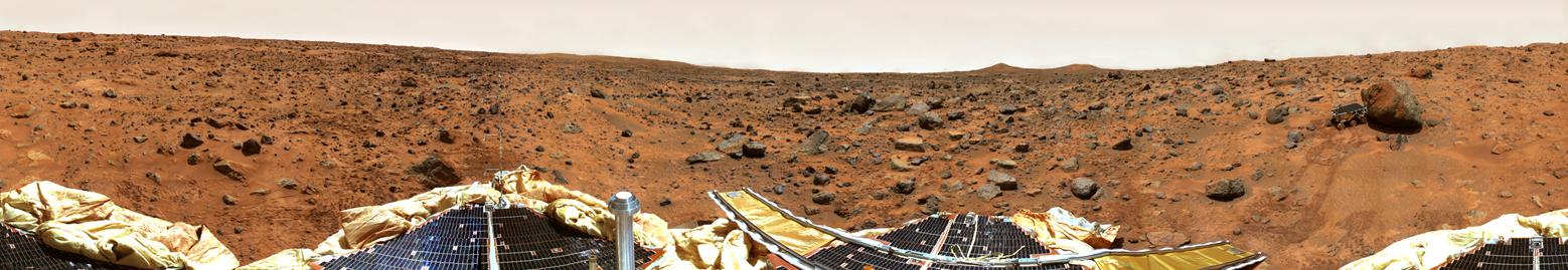
locations might be left. The most visually attractive
results
from the Pathfinder mission were a
high-resolution panorama
of the landing site:
The 1997 landing (July 4, in fact) of the
Mars Pathfinder spacecraft
and its Sojourner rover captured wise public attention. This was one of the
first news events in the Web, generating then-unprecedented millions of hits
per day. The landing would have been something to watch, as the probe cut away
its parachute, inflated air bags, and bounced and rolled to a stop.
Mostly a technology demonstrator, the Pathfinder probe (now the Carl
Sagan Memorial Station) also carried a set of filters to allow
discriminating various kinds of rock and soil, while Sojourner
was equipped with an X-ray experiment that enabled it to derive the
chemical (though not minerological) makeup of individual Martian
rocks. This demonstrated, for example, that the Martian meteorites found
on Earth really did belong to Mars. The
landing site was chosen with
an old geologists' trick, picking an area which showed evidence of
having once been at the outlet of a flood where rocks from many
locations might be left. The most visually attractive
results
from the Pathfinder mission were a
high-resolution panorama
of the landing site:
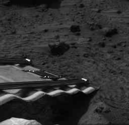
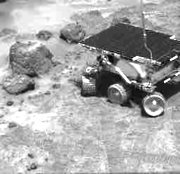
views from Sojourner looking back at the
lander which had carried it safely:
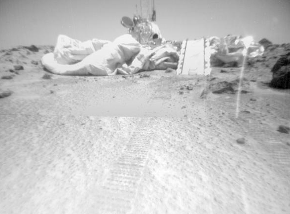
and movies of rover
operations on the surface, shown below.
 Currently returning spectacularly detailed images of Mars
(think of it as a low-budget reconnaissance satellite) is
Mars Global Surveyor, in orbit since September 1997.
MGS carries two cameras and a laser altimeter, which have
been used to examine the surface in new detail (not to
mention create a great new
National Geographic map). Some important
questions that it's addressed so far have been
Currently returning spectacularly detailed images of Mars
(think of it as a low-budget reconnaissance satellite) is
Mars Global Surveyor, in orbit since September 1997.
MGS carries two cameras and a laser altimeter, which have
been used to examine the surface in new detail (not to
mention create a great new
National Geographic map). Some important
questions that it's addressed so far have been
Where there ever oceans on Mars?
Did it have to be liquid water producing those channels?
Is there still geological activity on Mars?
What
scribbles on the dusty plains?
(
Dust devils!)
There are now over 123,800 MGS pictures of Mars,
publicly archived
for your inspection! These have turned up
landslides, dust
devils, amazing
patterns in the dunes as dry-ice frost sublimes
each Martian spring, and
detail in the ancient riverbeds. And then there's the
Face, not to be confused with the
Happy Face. Check this
gallery
if you don't have time for all 123,000.
The Great Space Ghoul apparently lives near Mars. Despite the stunning
successes, more probes have
been lost en route to Mars than have made it. Early on, the Mariners
were lost in pairs. This proved wise - Mariner 3 got stuck inside its
protective nose cone, Mariner 3 ended up at the bottom of the
Atlantic, Mariner 8 did likewise. The Soviet program fared even
worse, with four attempts failing to reach Mars, and only
a small data return from Mars 3,6, and 7 before they failed.
Things haven't improved much with expertise - the final Soviet
planetary probes, Phobos 1 and 2, met with disaster en route to
Mars and, heartbreakingly, close to Phobos. Mars '96 ended up
off the Chilean coast. Mars Observer was kidnapped by Elvis
just before entering Mars orbit. Mars Climate Orbiter will
be fodder for engineering and physics classes for years as a
classic foulup involving English/metric conversion (or
its lack). And it's still not completely clear what happened
to the Polar Lander in 1999.
Breaking the string,
Mars Odyssey 2001 reached
Mars orbit on October 24, 2001, carrying instruments
to detect subsurface water in much the same way
as the Lunar Prospector did for ice near the poles. In addition
to mapping the near-surface water, MO also generates
near-infrared
imagery of selected regions.
There are
general plans for a sample-return mission in a decade or so.
Meanwhile, detailed reconnaissance of the surface continues in the
form of NASA's twin
Mars Exploration Rovers,
Spirit and Opportunity, en route for landings January 3 and 24, 2004.
These will be able to travel much farther with more instruments than
the previous Sojourner rover, specifically targeting trhe history of
Martian water.
Slightly ahead of the MERs are
the European Space Agency's
Mars Express mission and
Beagle 2 lander, which will be equipped to drill into and
underneath rocks to look for hidden life. Express is set to enter
orbit around the planet on 26 December 2003.
Marsfest |
Bill Keel |
UA Astronomy |
Dept. of Physics and Astronomy |
University of Alabama
keel@bildad.astr.ua.edu
Last changes: August 2003